Thanks to her new girlfriend, my mother can knit in peace. Thanks to her new boyfriend, Jack, my sister-in-law Dana doesn’t mind driving to new places.
These friends are their Global Positioning Systems, of course. The ubiquitous talking satellite -programmed devices have made getting lost a thing of the past. And there’s rarely need to ask directions.
Maps, like most printed matter, are going the way of the yellow pages, the milkman, and the post office.
Reading Lane Filler’s essay “Marriage without Maps,” I thought about how the decline in map production, reduced due to rising printing costs and decreased demand, impacts an important skill we learned in grade school: map reading. Finding coordinates, understanding East-West, North-South, locating obscure places in atlases, and using maps to navigate, whether city streets or interstate highways, works the brain in ways listening to a GPS doesn’t.
Now, instead of standing on a street corner, reading a map, or pulling into a gas station to ask directions, we dutifully follow the instructions delivered to us in the accent and gender we select, rendering us less social. The chances of strangers offering assistance become more rare, lessening the opportunities to chat informally about an area with local residents. Instead of asking for restaurant suggestions, we can just type in a request into the GPS.
Growing up, my mother would knit while my father drove. Whenever they got lost, my father would blame the knitting. Now he can blame the GPS, personifying her. They aren’t always perfect.
I’m slow to rely on my smart phone for information. I still use a paper desk calendar, and prefer printed train schedules and movie listings. While I too use the GPS when by myself and happily let the GPS select the route when I’m a passenger so I can knit, I still like referring to the map.
Says Filler: “Good maps are, first off, works of art, colorful and expressive, resonant with the possibilities of places near and far… they allow us to understand the geography of the world, our place in it and how it all fits together.”

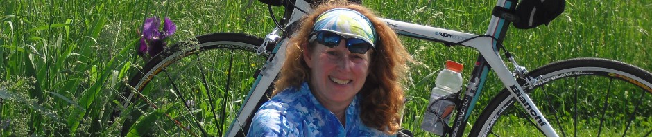
There’s nothing like a detailed map to plan a cycling route or explore a city. Sure, we get lost now and then. Sometimes getting lost reveals places and scenery the GPS would never find.

Absolutely looove maps for all the things you listed. If something goes wrong, I know where I am & can quickly use an alternate route. Or just travel on routes I know I like, add an extra stop if I discover I’ll be unexpectedly close to something else, or whatever! Afraid l, too, still use paper for lots of things. 😉
LikeLike
I always take a map, just in case. Mapreading is a great skill to have.
LikeLike
I loved reading this! Although I do rely on the GPS a lot, I do think about the mindlessness of it… I greatly appreciate Yaakov’s responsibility in making sure both cars have relevant maps. I’ve actually used them a few times!
LikeLike
I’ve been tricked by the GPS maps enough times that I still don’t rely on them. I still like the printed ones too, plus, I’m too thrifty to have a smart phone. Sometimes though I wish I had sprung for the heart rate monitor with GPS so I could print out my bike rides after!
LikeLike
I’m a map person, love to get lost on the back roads 🙂
LikeLike
You got me thinking about the GPSs in my life and not just the ones who get me from one physical location to the other!
LikeLike
Thanks for the like and signing up. I’m curious about the other “GPS” es… keep me posted!
LikeLike
map and gps in one aplication : http://www.endomondo.com/workouts/tBfg4RxCWmk
i always using this when cycling
LikeLike
Great work for this week theme Lisa, Thanks for sharing 🙂
LikeLike
Thanks for inspiring!
LikeLike
Back in the late 60’s and early 70’s, my husband and I drove cross-country and across a good part of southern Canada…we always had our trusty AAA trip-tik…detailed map with the direct AND road-less-taken guidelines highlighted with marker. I’m thinking a GPS would have made life a little easier, had they been available back in the day. 🙂 But, kind of like using a calculator to balance a checkbook vs. doing it the old-fashioned way that uses your brain, perhaps we should all use old-fashioned maps now and then, so keep our navigational skills alive. 🙂
Love your post, Lisa…thanks for a wonderful entry to “road”. 🙂
LikeLike
Thanks for the ping back. Growing up, we traveled across the country and had those trip-tiks–loved them. But also had the big maps that helped us see where we actually were.
LikeLike
Pingback: Sunday Post: Road: Which One Will You Follow? « Positive Parental Participation
I do like paper maps. I recently found out the GPS on my phone uses up my battery then I’m stuck with nothing if I didn’t have a map.
LikeLike
Love the post Lisa. I’m another old fashioned soul who loves to pore over maps and imagine the place. I don’t have a smart phone so when I hit the ground running in a new place I’m always clutching a map. Doesn’t help too much as I have NO sense of direction but at least I can look at the map to see what street I’m lost in!
LikeLike
Thanks! I have no sense of direction either but love looking at maps.
LikeLike
Reblogged this on Aaron Laird Site.
LikeLike
rtpgyj yfznhaoxv pwwsjm
LikeLike